WESTERN MONMOUTH DEVELOPMENT PLAN
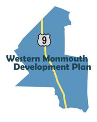
The Western Monmouth Development Plan is Monmouth County’s first regional study aimed at managing growth and development in the seven municipalities of Englishtown, Farmingdale, Freehold Borough, Freehold Township, Howell, Manalapan and Marlboro. These Route 9 corridor municipalities comprise the most rapidly developing area of the county and one of the fastest growing regions in the state. Population growth and residential and commercial development activity surged during the past decade. Once a two-lane roadway that connected farming communities, Route 9 has evolved into a four-lane divided highway that does double duty as a commuter expressway and as a suburban “Main Street”.
The Western Monmouth Development Plan is a product of the Route 9 Baseline Condition Report prepared by the Monmouth County Planning Board and the Route 9 corridor municipalities in 1999. The Baseline Report identified roadway deficiencies and opportunities for improvement along the 19-miles of Route 9 roadway in Monmouth County. But because traffic and land use are inter-connected, all partners in the Baseline study agreed to move forward with a planning study that goes beyond the curbs and parking lots of Route 9.
The Monmouth County Planning Board, with the support of the seven Western Monmouth/Route 9 municipalities, applied for and was awarded a $250,000 Smart Growth Planning Grant from the New Jersey Department of Community Affairs to conduct a comprehensive planning. study of the Western Monmouth region. Following a stringent selection process, the Planning Board retained the services of Orth-Rodgers & Associates, in association with the Hillier Group, to perform the planning study.
The project will seek to accomplish the following:
- Establish a cooperative planning effort to review land use, transportation, redevelopment and public facilities and services in a regional context.
- Develop strategies, policies and design guidelines that address local concerns.
- Support the long-term goals and objectives of the Route 9 municipalities.
- Create a land use and design vision for the Route 9 municipalities and the region.
- Achieve endorsement by the New Jersey State Planning Commission as a Regional Strategic Plan.

Project Scope
- Task 1 Project Initiation – During Task 1, municipal representation was established and stakeholders were invited to participate in the Collaborative (Project Status: Complete).
- Task 2 Corridor Profile – Establishes baseline conditions, identifies problems and makes projections of future conditions (Project Status – Complete).
- Task 3 Alternatives Analysis – Identify alternative “What If?” strategies to address needs and issues, prepare a strategies guidebook and conduct a strategies workshop (Project Status – Complete).
- Task 4 Creating the Vision – Provides the Collaborative with the opportunity to create a vision for the Route 9 corridor (Project Status – Complete).
- Task 5 Developing the Plan – Will identify how the planning alternatives will be implemented (Project Status – Complete).
- Task 6 Final Plan – Will incorporate the results of Tasks 1 through 5 in a comprehensive report (Project Status – Complete).
Reports: